NuSTAR telescope maps supernova core
March 10, 2014
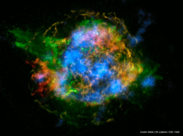
NASA’s newest x-ray telescope has produced the first map of radioactive material in a supernova remnant, revealing new information on how stars explode.
March 10, 2014
NASA’s newest x-ray telescope has produced the first map of radioactive material in a supernova remnant, revealing new information on how stars explode.

January 14, 2014
NASA’s Nuclear Spectroscopic Telescope Array (NuSTAR) has produced new images of a pulsar wind nebula, revealing a striking formation nicknamed the “Hand of God”.

September 10, 2013
Arsenic toxicity of humans due to consumption of arsenic-contaminated rice is an international health crisis. Arsenic is often supplied through water from shallow wells used for irrigation of rice. Reduced soil conditions present in flooded rice fields enable the arsenic to be converted to a form that is easily taken-up by the plants. Arsenic levels […]
July 31, 2013
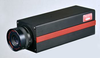
Announcing the release of the SOC716 Full Motion Video Spectral Imaging system. FMV-SI simultaneously captures and process all three dimensions of a spectral cube at 60Hz video rates through a novel, plenoptic based design. Systems are available in the UV (300-500nm), SWIR (1000-1700nm), and VNIR (450-950 nm) spectral ranges.

July 10, 2013
Environmental and remote sensing scientists at UC Berkeley are utilizing SOC710-VP ground spectral imaging data, along with airborne and satellite data in a geospatial context for revising and improving the Berkeley Emission Estimation System (EES).

June 28, 2013
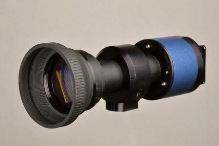
University of Connecticut marine science Ph.D. students Brandon Russell and Eric Heupel took the SOC710-VP hyperspectral imaging system aboard the 72-foot Sea Dragon research vessel last month, during an expedition to the Sargasso Sea off the Islands of Bermuda.

April 30, 2013
Surface Optics’ full-motion video spectral imager (FMV-SI) participates in U.S. Navy’s 4th Fleet airship capabilities demonstration flights. FMV-SI combines the real-time, situational awareness provided by full-motion video with the spectral intelligence that aids in the detection, identification and management of targets based on their inherent signature.

April 11, 2013
Hyperspectral imaging meets marine biology in our interview with Berkeley researcher Lindsay Dougherty on her application of the SOC710-VP hyperspectral imaging system to her research on ‘Disco Clams’.
March 26, 2013
Surface Optics will be offering demonstrations of our new SOC710-GX airborne Vis/NIR spectral imaging system at this week’s ASPRS Conference in Baltimore, MD. The SOC710-GX is a complete airborne spectral imager, specifically designed for ease of installation in a UAV or small aircraft. The compact system delivers real-time, research-grade results covering the 400-1000 nanometer wavelength […]
March 19, 2013
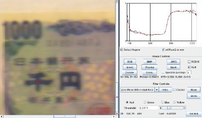
Hyperspectral imaging and forensic document analysis presentation at Southwestern Association of Forensic Document Examiners, April 4-7.